We offer services in aerial photography and processing of materials to obtain an orthophotoplane, a height matrix and a 3D model of the terrain. The shooting is carried out on the basis of unmanned aerial technology with a professional full-frame camera. Photogrammetric processing is performed in special software. Aerial photography from a UAV ― the… Continue reading Aerial photography
Category: Remote sensing of the earth
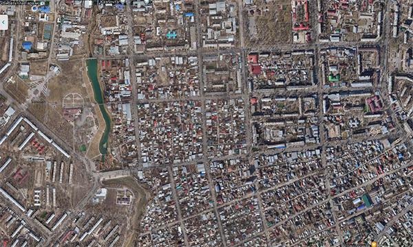
Thematic and topographic mapping
The KAZGISA company offers an extensive range of services to provide the customer with digital cartographic materials. Cartographic works include a large range of services, activities for processing, formation, research, use of cartographic data. The creation (updating) of maps (plans) is carried out after the completion of preparatory work, if necessary, the performance of field… Continue reading Thematic and topographic mapping
Monitoring of land use
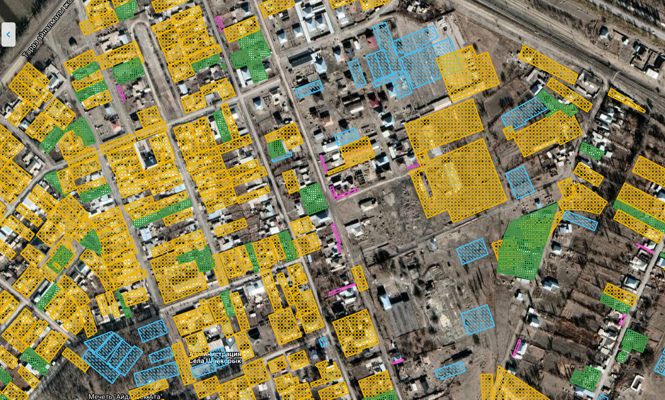
The State monitoring of lands is a system of observations of their condition and use. In the process of monitoring, information is collected that is necessary for making informed management decisions by state and local government bodies whose activities are aimed at ensuring the rational use and protection of land. This information is also necessary… Continue reading Monitoring of land use
Monitoring of common minerals
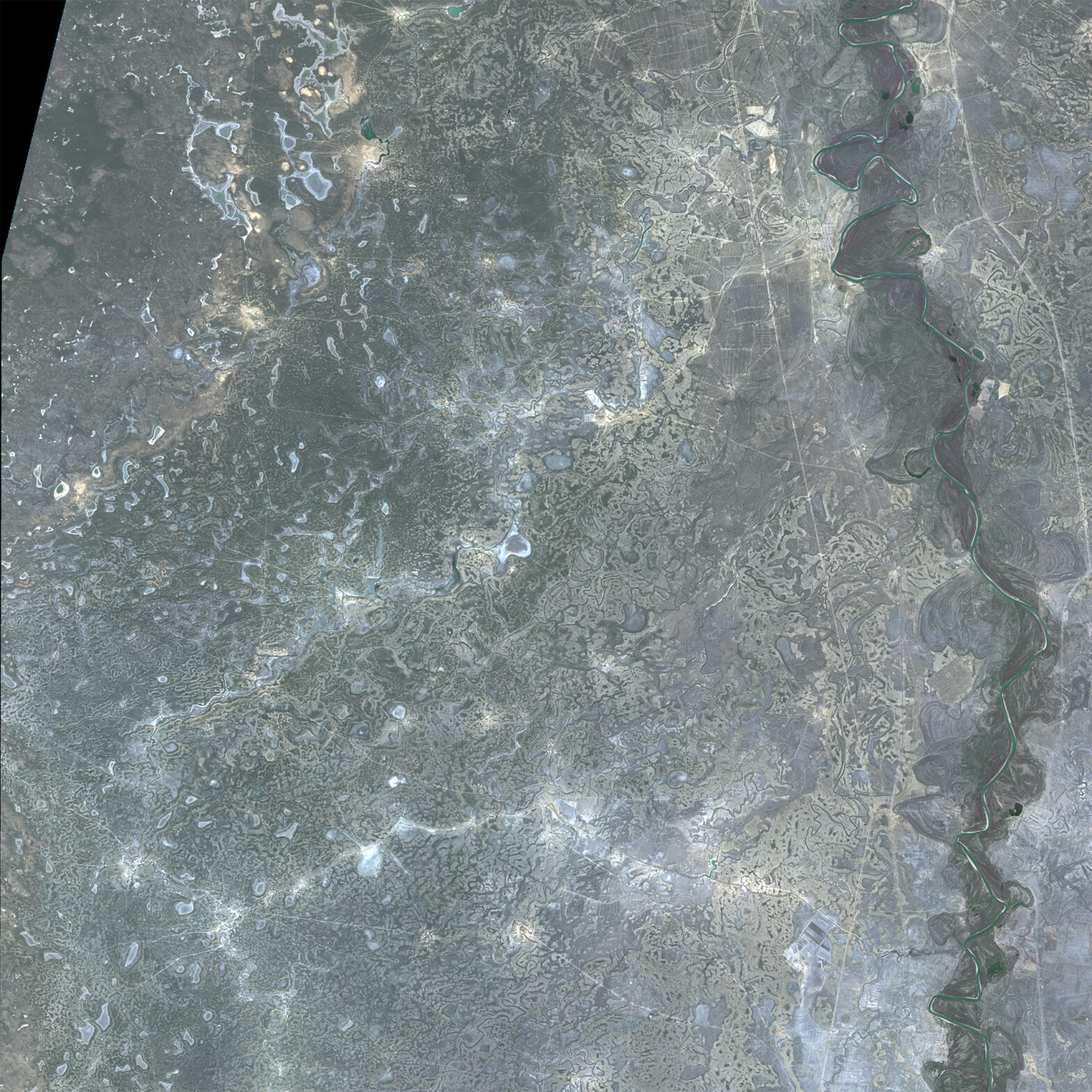
This type of monitoring is aimed at finding out the actual area of subsurface use and calculating the volume of excavation for a certain period. Monitoring is carried out based on remote sensing materials with a spatial resolution no worse than 1 m and obtained by stereo photography.
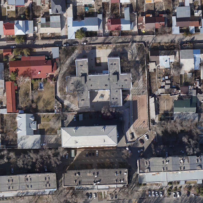
3D aerial photography
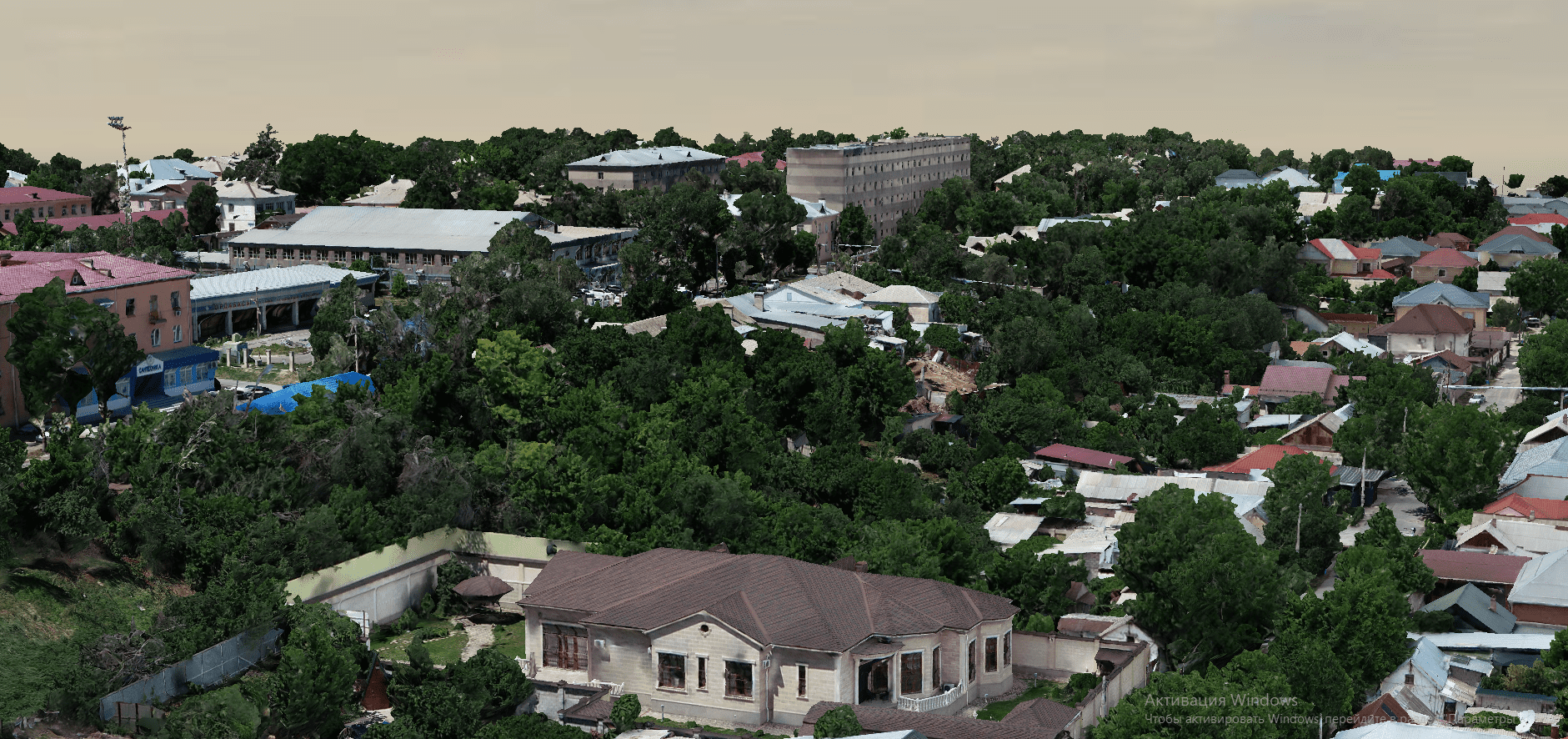
Realistic 3D models of terrain or objects with accurate geodetic references can serve as the basis for developing a digital twin of a city. By linking reference points to the terrain in the required coordinate system, the resulting models have a colossal amount of accurate geodetic data. The model is built by identifying terrain objects… Continue reading 3D aerial photography