The Department of Construction, Architecture and Urban Planning, in order to implement the State Program “Digital Kazakhstan”, taking into account the “Uniform Requirements for Geoportals of LIE”, developed the Regional Geographic Information System (hereinafter – RGIS).
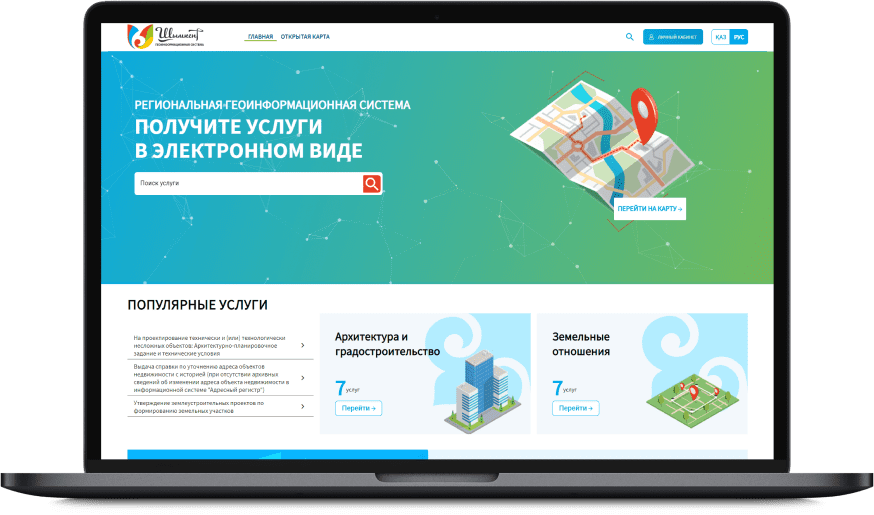
RGIS is intended for the collection, storage and graphical visualization of spatial data, as well as for the integrated provision of public services in the field of land relations, construction, and urban planning in electronic form using cartographic data. This feature of the RGIS will ensure transparency in the provision of public services.
In addition, the system implements the possibility of electronic coordination of documents between various structures of the akimat and utility organizations, which reduces the time for rendering services. Previously, for example, the department of land relations and the department of construction, architecture and urban planning of the city, located in the same building, had to write official requests to each other in paper form. Now these requests have been fully translated into electronic form, which saves not only time, but also the cost of office supplies.
Thanks to the integration of the RGIS with the republican information system “Unified State Real Estate Cadastre”, within the framework of the pilot project, it will be possible for residents to obtain land plots both directly and through bidding within the framework of composite services, when a number of documents issued by various state bodies are prepared within the framework of a single application of the applicant, and the terms for obtaining these documents will be reduced significantly. Now, at the level of central state bodies, the legal basis for the launch of the pilot project is being prepared.
The cartographic component of the RGIS consists of an open and a closed contour. The open circuit is intended for the population and entrepreneurs of the region, while the closed circuit is intended for employees of state bodies and subjects of natural monopolies.
The map will periodically publish information about upcoming land sales with a detailed description of the conditions for participation in the auction. Everyone can get acquainted with the approved master plan for the development of the city, with the approved detailed planning projects, with red lines, in the existing and planned part of the city and other information.
The list of data available in the open loop will be constantly expanded.
Today, organizational work is underway on certification of the RGIS for information security in the State Technical Service of the KNB of the Republic of Kazakhstan.
The system module for the provision of services is now being implemented in the relevant organizations, employees are being trained, and test applications are being processed. The launch of this module will be announced soon. The cartographic module is already available for the population and employees of the akimat.