If there is a land plot, what can be placed on it, what to build, what requirements does the administration impose? These and many other points are determined by the PDP – a detailed layout plan. The document reflects the scheme of the district in the city system, urban planning zoning, places for housing, educational… Continue reading Digital PDP
Category: Development of IT concepts
RGIS

The Department of Construction, Architecture and Urban Planning, in order to implement the State Program “Digital Kazakhstan”, taking into account the “Uniform Requirements for Geoportals of LIE”, developed the Regional Geographic Information System (hereinafter – RGIS). RGIS is intended for the collection, storage and graphical visualization of spatial data, as well as for the integrated… Continue reading RGIS
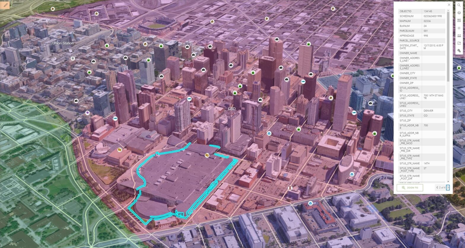
Digital Twin

Digital Twin is a virtual platform based on 2D 2D and 3D 3D data that is used to model urban change and improve city governance. The platform displays all the details of the city in a 3D model and is used to predict the future development trends of the city. Digital Twin will be the… Continue reading Digital Twin
Digital Master Plan
Implementation of digital projects, such as a digital city master plan, provides an opportunity to predict and model urban development processes, data on the need to provide certain areas with hospitals, schools, kindergartens, to see the state of existing and planned road networks. Creating a spatial three-dimensional layout of the general plan will allow you… Continue reading Digital Master Plan
Digital PDP
If there is a land plot, what can be placed on it, what can be built, what are the requirements of the administration? These and many other points are determined by the RAP – the detailed planning plan. The document reflects the scheme of the district in the city system, urban zoning, indicates places for… Continue reading Digital PDP