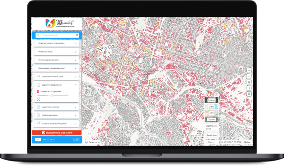
Geographic information system – a system for collecting, storing, analyzing and graphical visualization of spatial (geographical) data and related information about the necessary objects.
The concept of a geographic information system is also used in a narrower sense – as a tool (software product) that allows users to search, analyze and edit both a digital map of the area and additional information about objects.
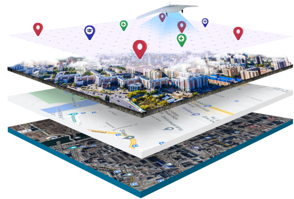
Spheres and areas of application of geoinformation systems:
Land management, land cadastres – compilation of cadastres, classification maps, determination of the areas of plots and boundaries between them, etc. Inventory, accounting, planning for the placement of distributed production infrastructure facilities and their management.
Urban planning – solving problems of developing the territory, optimizing the infrastructure of the area under construction, the required amount of equipment, forces and means, etc.
Natural resource management, environmental protection and ecology. GIS helps to determine the current state and reserves of observed resources, models processes in the natural environment, and carries out environmental monitoring of the area.
Geology, mineral resources, mining industry. GIS performs calculations of mineral reserves based on the results of samples (exploratory drilling, test pits) with a known model of the deposit formation process.
Agriculture. Accounting for agricultural land, identifying the legality of their use.
Thematic mapping – to solve specific problems of the Customer.