Inspection and restoration of points and signs of the state geodetic and leveling networks of the Republic of Kazakhstan is carried out in order to check their safety on the ground and maintain them in good condition for use in topographic, geodetic and engineering survey work, as well as satellite definitions in the interests of the national economy and defense of the country.
Field work on the survey of geodetic points
consists in finding points on the ground and establishing the state of their centers, signs, reference points (ORP) and external
design.
Restoration of geodetic points provides for the performance of all the work necessary to bring their centers, signs, ORP and external design in accordance with the requirements of the current regulatory and technical documents on the construction of the state geodetic network.
The definition of new geodetic points to replace the lost
ones is not included in the work on the restoration of points and, if necessary, is carried out according to a special task, as a condensation of points of the state geodetic network.
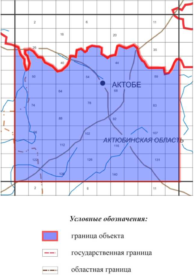
Completed works in Aktobe, Atyrau and West Kazakhstan regions
The following works have been performed at the facility:
- Survey of points of the state geodetic network;
- Inspection of signs of the state leveling network.
During the survey of triangulation points and leveling signs of classes III, IV, materials containing information about geodetic networks located within the boundaries of the object and survey materials of points and leveling signs of previous years were used.
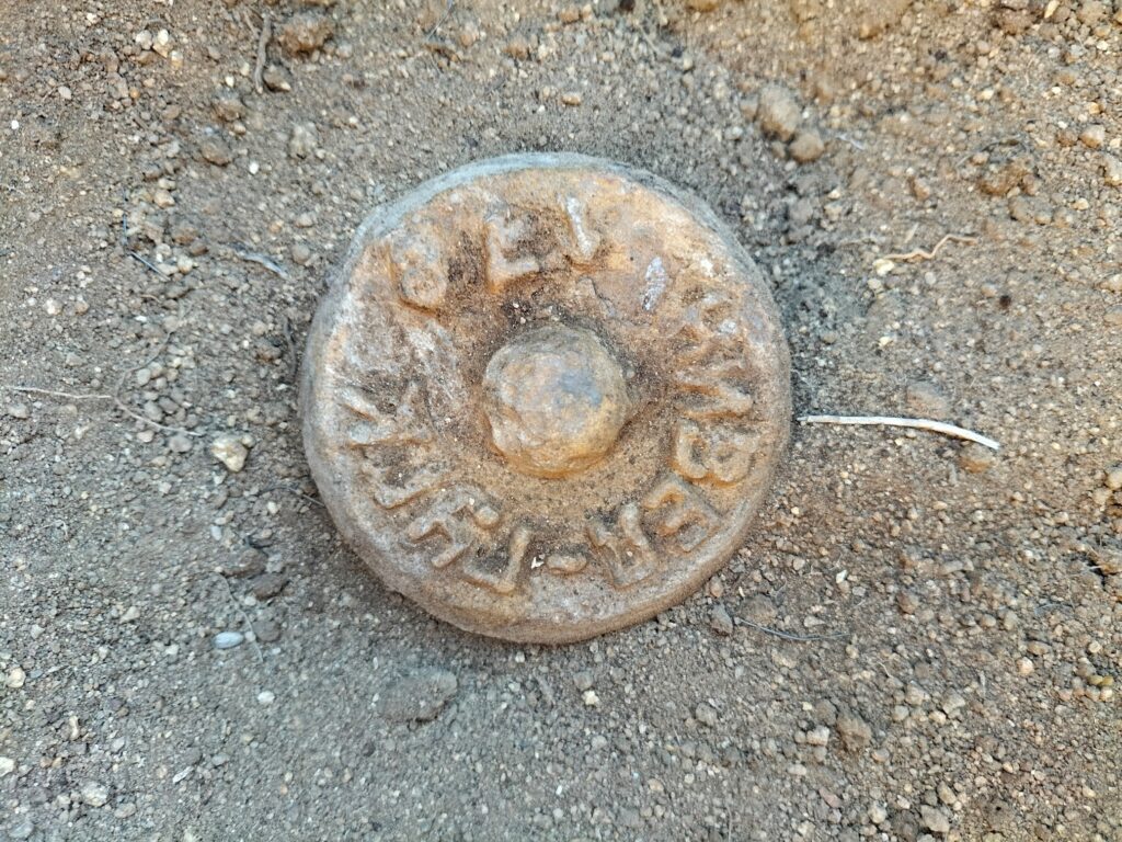
Based on these materials, all geodetic points were plotted on topographic maps, and their technical data (the name of the point, class, type and height of the sign, type of center, stamp number) were written out in the survey cards of geodetic points.
Topographic maps with geodetic points and survey cards with technical data were used in the production of field work.
The survey of triangulation points was performed in the following sequence:
- Finding points on the ground using topographic maps at a scale of 1:100,000, based on the external signs preserved on the ground and using Garmin Montana 700i navigation satellite receivers;
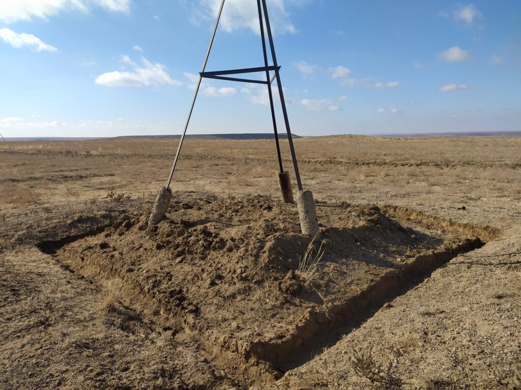
- Inspection of points and determination of the degree of preservation of the outer sign and the upper mark of the center, external design, reference points;
- Photographing stamps of preserved centers;
- Processing and registration of accounting documentation based on the results of the survey of points.
During the survey of each preserved geodetic point, the safety of reference points, the condition of their centers and identification poles were checked.
All information characterizing the condition of the point is entered by the contractor in the “Survey and restoration card of the geodetic point”.
The survey of signs of the state leveling network was subject to ground reference points that meet the requirements of the Leveling Instructions of Classes I, II, III and IV, GKINP (GNTA) — 03-002-07 in terms of accuracy of determination. Astana, 2007,
General results of survey of points of geodetic and leveling networks:
- Of the examined 52 points of triangulation, 7 points were lost;
- Of the examined 811 leveling signs, 211 were not found, 55 signs were lost.
At the end of the field work on the survey , the following documents are submitted for delivery ::
- Survey cards of geodetic points filled in for each preserved point;
- Photos of stamps of the centers of triangulation points;
- Acts on the loss of points of the state geodetic network;
- Acts on the loss and undiscovered signs of the state leveling network;
- Schemes of the performed survey of geodetic points, leveling signs with preserved and lost points and signs applied;
- A brief report on the work performed.