
GEOPPORTAL is a platform for geodata, information and geoservices GEOPORTAL PROVIDES FOLLOWING SERVICES: Displaying raster, vector layers; Search and cartographic visualization of data; Collecting and storing large amounts of data; Converting data from external systems into the Geoportal database GEOPORTAL FUNCTIONALITY Open part for the public Closed part for official use Open map for the… Continue reading Map services (geoportals)
Author: admin
Development of the master plan
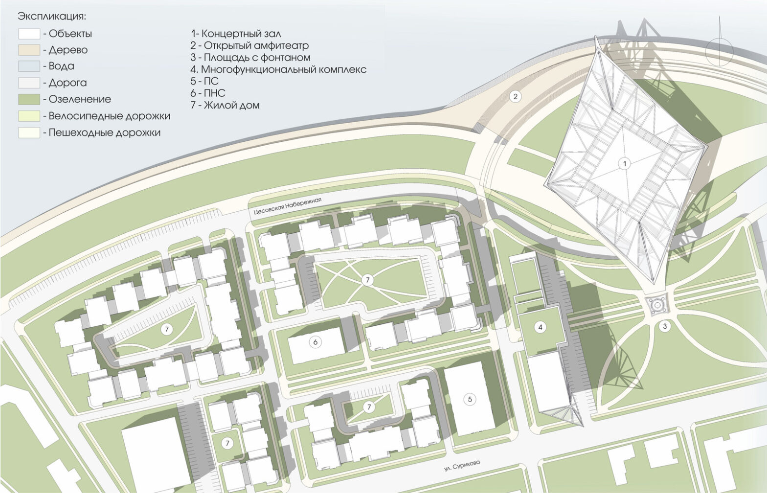
The master plan is a document that is being prepared for plots intended for development. The general plan of the site is necessary for the development of the project and evaluation of its technical and economic indicators. This is the basic scheme, which contains data on the structure of the site, its zoning, transport provision… Continue reading Development of the master plan
Development of a detailed planning plan (PDP)
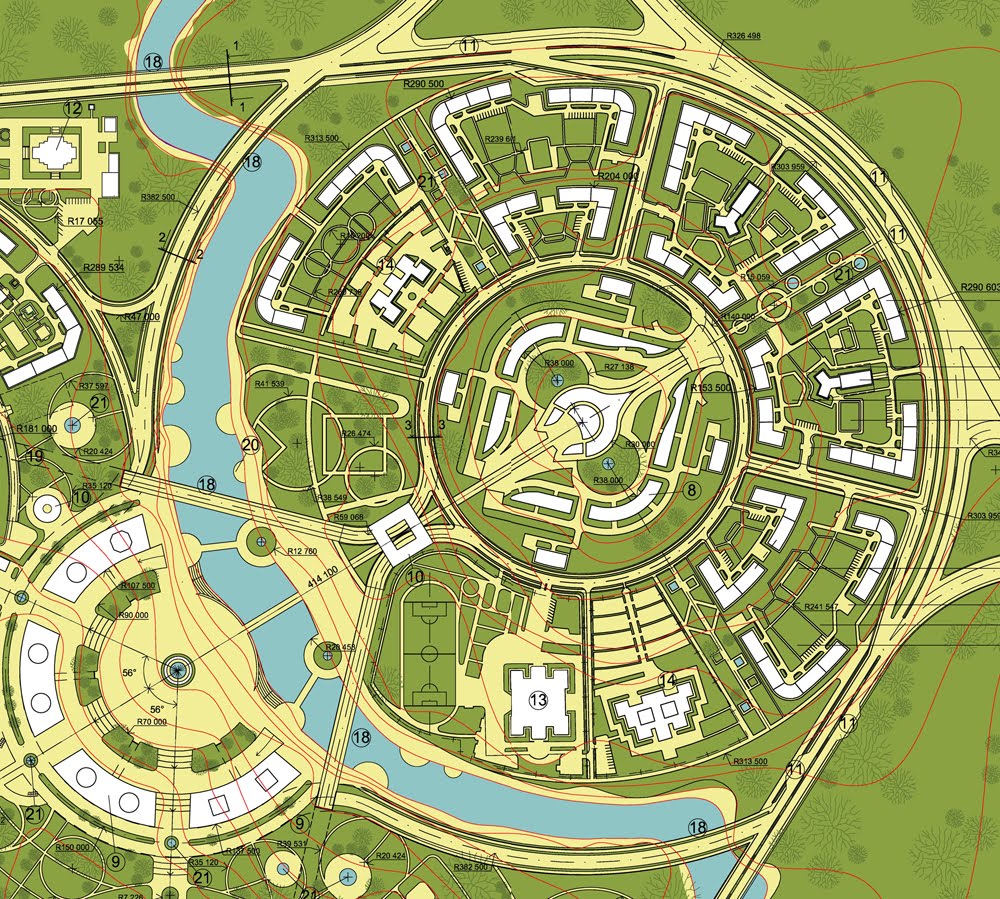
If there is a land plot, what can be placed on it, what to build, what requirements does the administration impose? These and many other points are determined by the PDP – a detailed layout plan. The document reflects the scheme of the district in the city system, urban planning zoning, places for housing, educational… Continue reading Development of a detailed planning plan (PDP)
Laser scanning
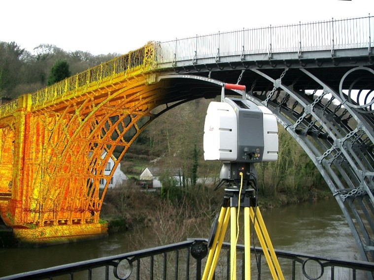
Laser scanning a method that allows you to create an accurate digital model of the surrounding space (an object in space) by presenting it with a set of points with spatial coordinates. The main difference between the laser scanning method and traditional total stations is the co-ordinally high speed and density of measurements in the… Continue reading Laser scanning
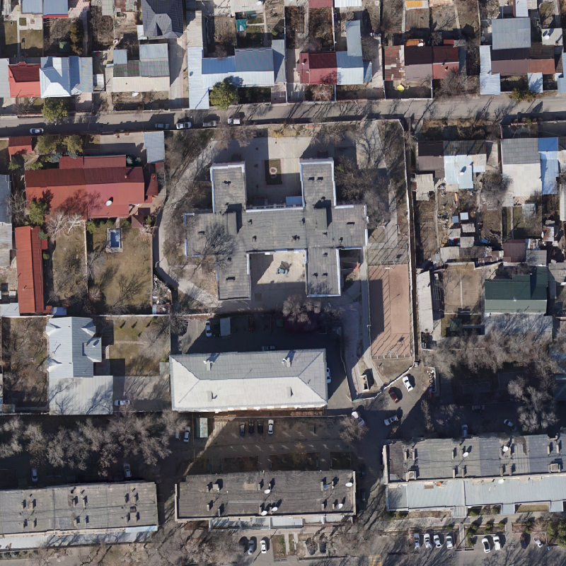
Aerial photography
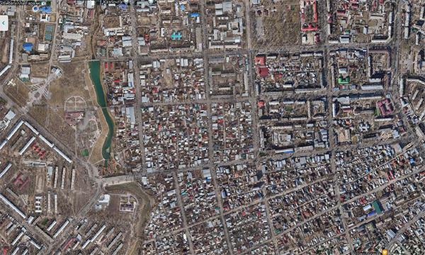
We offer services in aerial photography and processing of materials to obtain an orthophotoplane, a height matrix and a 3D model of the terrain. The shooting is carried out on the basis of unmanned aerial technology with a professional full-frame camera. Photogrammetric processing is performed in special software. Aerial photography from a UAV ― the… Continue reading Aerial photography
Thematic and topographic mapping
The KAZGISA company offers an extensive range of services to provide the customer with digital cartographic materials. Cartographic works include a large range of services, activities for processing, formation, research, use of cartographic data. The creation (updating) of maps (plans) is carried out after the completion of preparatory work, if necessary, the performance of field… Continue reading Thematic and topographic mapping
Monitoring of land use
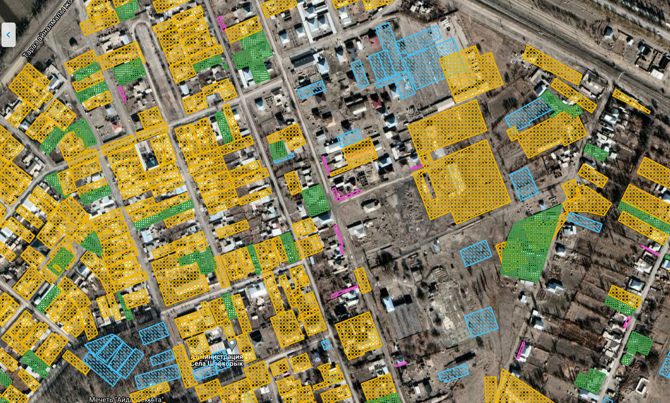
The State monitoring of lands is a system of observations of their condition and use. In the process of monitoring, information is collected that is necessary for making informed management decisions by state and local government bodies whose activities are aimed at ensuring the rational use and protection of land. This information is also necessary… Continue reading Monitoring of land use
Inventory of engineering networks

The KAZGISA company offers services on inventory of engineering networks: Engineering support of the city is one of the most important components of its infrastructure. Engineering support systems consist of head structures (pumping stations on water supply, sewerage and heat supply networks; central and control and distribution points on heat supply networks; gas distribution points… Continue reading Inventory of engineering networks
Creating three-dimensional models
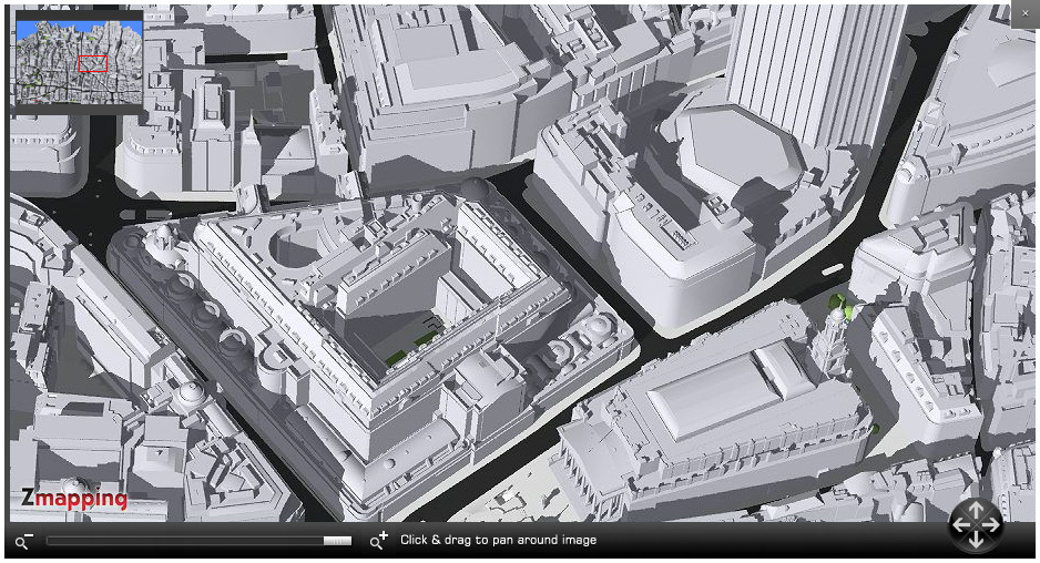
What is BIM? Building Information Modeling (BIM) is a process based on the use of intelligent 3D models. With this technology, Architecture and Construction (AEC) specialists can plan, design, build and operate buildings and infrastructure facilities even more efficiently. What is BIM technology used for? BIM technology is used to design and document projects of… Continue reading Creating three-dimensional models
PLM Systems (Product Lifecycle Management Systems)
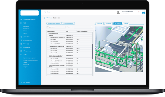
PLM system (English product lifecycle management) is an application software for product lifecycle management. PLM technologies combine methods and means of information support of products throughout all stages of their life cycle. A characteristic feature of PLM is the interaction of both automation tools from different manufacturers and various automated systems of many enterprises, that… Continue reading PLM Systems (Product Lifecycle Management Systems)